Residential location decisions without considering long-term (cost) effects do not only influence mobility costs of private households, but often cause an extension of residential living area far away from existing infrastructural supply. This in turn leads to increasing individual motorized traffic and negative environmental effects:
 versus
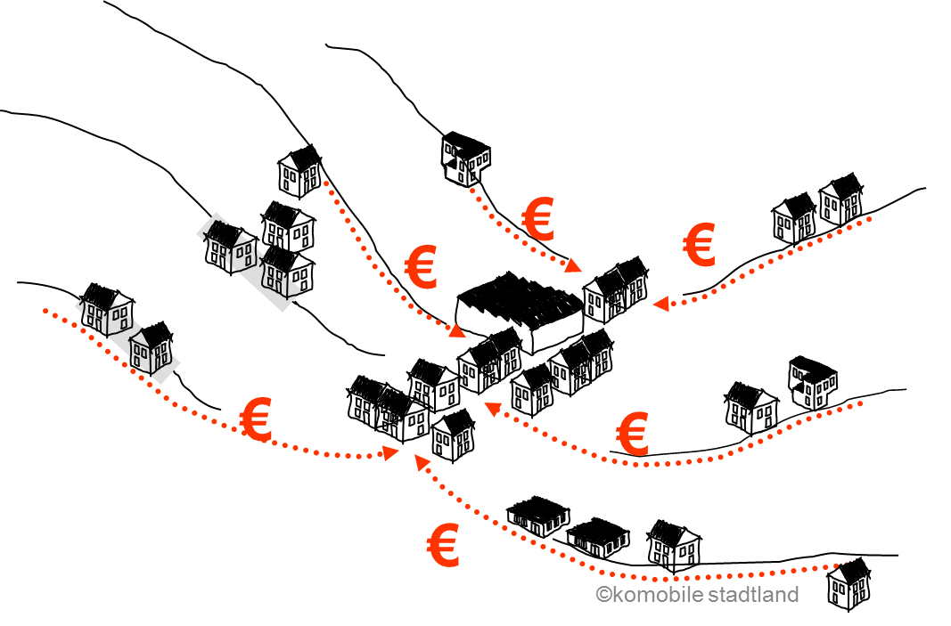
Thus, analyses of various regions, also cross-border/transnational, concerning accessibility and reachability of public transport axes, public transport stops, and facilities of daily needs, as well as the assessment of suitable residential locations and areas for sustainable settlement development have been conducted. A checklist of planning criteria in the form of a web-tool was created for the city of Salzburg (Checkliste) to foster the sustainability of building projects. Another web-based planning tool to estimate follow-up costs of residential building projects, e.g. concerning mobility costs of future inhabitants, as well as a cost calculator for private households was developed (MORECO).
iSPACE has supported and developed a bunch of planning strategies, toolboxes, and evaluation tools to counteract the aforementioned negative consequences. All analyses were conducted with methods of spatial data processing and Geo-Information-Systems (GIS), mostly based on a small-scale raster data. Research done in this field provides solid basics for sustainable spatial planning, planning strategies and helps in awareness rising and reducing information and knowledge insufficiencies.
Relevant projects:
- EULE (Interreg IIIa project “Euregionale Raumanalyse” – 2008-2010)
- MORECO (Alpine Space Project “Mobility and Residential Costs” – 2011-2014)
- Checkliste (Web-based information service – a check list of future-oriented housing – 2012-2013)
- NaWo (Nachhaltige Wohnstandortentscheidungen – 2013-2015)
Contact persons @ iSPACE:
- Mag. Wolfgang Spitzer: wolfgang.spitzer@researchstudio.at
- Dagmar Lahnsteiner (ehem. Schnürch): dagmar.schnuerch@researchstudio.at