Detecting unused parcels for residential use

Grafiken_SSS_eng_v01


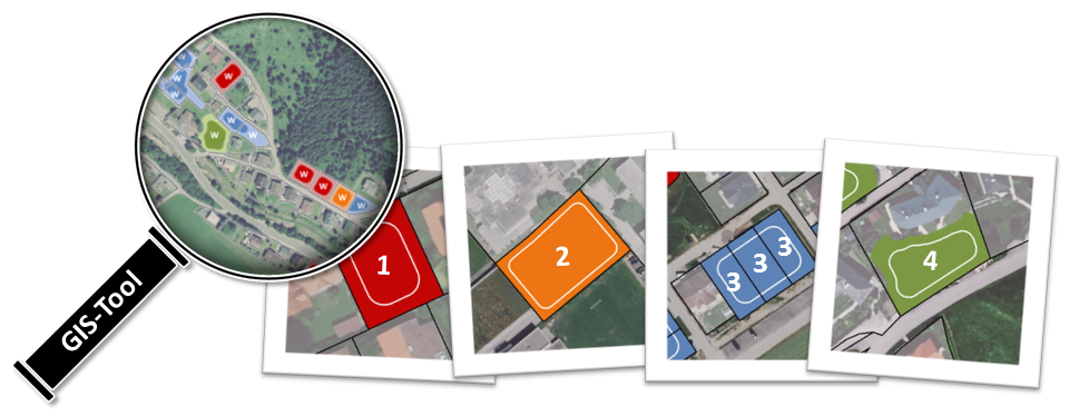
The knowledge of the amount and location of potential building land is important for spatial planning. Lacking in standardized and comparable information, iSPACE developed a method for the detection of unused but dedicated reserves for residential use on a parcel-scale. The GIS-tool was also calibrated for crossborder use in Austria and Germany and can identify serveral types of reserves.
Using demographic projections, scenarios can be created, whether and how long the future demand for building land can be met. Thereby spatial planners can evaluate and optimize measures for preventing urban sprawl by mobilization of existing reserves without opening up new building land.

Smart settlement systems

header_smart_settlementsKopiegroß

Main topics of Smart Settlement Systems encompass the research fields of smart mobility (mobility measurements in the building context, linkage of residential housing locations with regional mobility systems and intermodal/ alternative mobility offers, support of fair and balanced mobility), smart environment (re-densification models, coupling of building land potentials with housing demands, space simulations and resource efficiency), smart energy (further development of energy certificates, total energy demand modelling, holistic energetic solutions and certification of settlements, energy balancing and renewable energies) as well as smart governance (elaboration of new directives and strategies in the context of settlement development, re-densification and refurbishment, integration of public and regional authorities as enablers as well as spatial simulation of new governance measures).