Start des Projekts Urban Green Belts

ugb_stellenausschreibung

Das Studio iSPACE – Smart Settlement Systems freut sich über den Start des Projekts “Urban Green Belts”, welches vom Europäischen Fonds für Regionalentwicklung im Rahmen des Central Europe Programmes, gefördert wird.

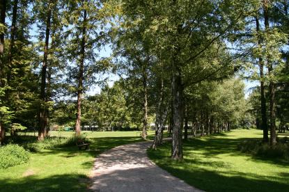
Grüngürtel sind v.a. im urbanen Bereich bedeutend im Hinblick auf Wirtschaft, Umwelt und Soziales. Beispielsweise sind sie in der Lage, Schadstoffe aus der Luft zu filtern, Hitzeinseleffekte zu mindern und in wirtschaftlicher Hinsicht u.a. eine fördernde Wirkung auf die Tourismusbranche auszuüben oder Immobilienwerte zu erhöhen. Generell leisten Grünräume einen wichtigen Beitrag zur Verbesserung der Lebensqualität und der öffentlichen Gesundheit. Die Bedeutung städtischer Grünflächen ergibt sich damit v.a. aus ihrer Fähigkeit, einigen der negativen Effekte in urbanen Ballungsgebieten entgegenwirken oder diese zu vermindern.

Im Rahmen des Projekts sollen zunächst Methoden definiert werden, mit deren Hilfe eine Grünraumbewertung im städtischen Raum durchgeführt werden kann. Weiterhin sollen transnational reproduzierbare Modelle für das städtische Grünraummanagement sowie partizipative Ansätze, durch die die Öffentlichkeit in Entscheidungsprozesse im Bereich Grünraumentwicklung einbezogen wird, entworfen und umgesetzt werden. Das finale Resultat des Projekts bildet ein GIS-basiertes Tool für Grünflächenmanagement und -entwicklung. Durch die beschriebenen Maßnahmen soll ein Beitrag zur Verbesserung der Lebensqualität in städtischen Räumen geleistet werden. Die gesamte Projektarbeit findet dabei in Kooperation mit Partnern aus verschiedenen Ländern (Ungarn, Slowenien, Polen, Italien, Tschechien und Kroatien) statt.

Logo_InterregCentralEurope

Checking infrastructure availability

screen_alpbc_blog

As part of the Alpine Space Project “AlpBC” a prototype web tool has been developed, which allows to gain information on the available infrastructure surrounding any address in the Salzburg region.

This tool provides a simplified and easy-to-use prototype approach to analyze the availability of surrounding infrastructure of buildings and thus supports an objective approach to estimate the accomplishment of sustainable settlement development.

It provides the following features:

  • Analysis of infrastructure categories in
    • Mobility
    • Daily supply
    • Energy
  • A mobile web map client
  • Dynamic calculation of routes and walking distances to amenities
  • Drawing of walking routes inside the map
  • Complete coverage of the area of the province of Salzburg

Current URL: http://ispacevm34.researchstudio.at/alpbc/

Detecting unused parcels for residential use

Grafiken_SSS_eng_v01


The knowledge of the amount and location of potential building land is important for spatial planning. Lacking in standardized and comparable information, iSPACE developed a method for the detection of unused but dedicated reserves for residential use on a parcel-scale. The GIS-tool was also calibrated for crossborder use in Austria and Germany and can identify serveral types of reserves.
Using demographic projections, scenarios can be created, whether and how long the future demand for building land can be met. Thereby spatial planners can evaluate and optimize measures for preventing urban sprawl by mobilization of existing reserves without opening up new building land.

Smart settlement systems

header_smart_settlementsKopiegroß

Main topics of Smart Settlement Systems encompass the research fields of smart mobility (mobility measurements in the building context, linkage of residential housing locations with regional mobility systems and intermodal/ alternative mobility offers, support of fair and balanced mobility), smart environment (re-densification models, coupling of building land potentials with housing demands, space simulations and resource efficiency), smart energy (further development of energy certificates, total energy demand modelling, holistic energetic solutions and certification of settlements, energy balancing and renewable energies) as well as smart governance (elaboration of new directives and strategies in the context of settlement development, re-densification and refurbishment, integration of public and regional authorities as enablers as well as spatial simulation of new governance measures).